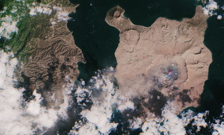
Volcano observatories are refining how they track ash clouds, a hazard that can drift hundreds of kilometres and threaten aircraft engines at cruising altitude. Volcanic ash is not soft like wood ash; it contains tiny fragments of rock and glass that can melt inside jet engines and damage cockpit windows. New combinations of satellite sensors, ground cameras, and weather models allow forecasters to map ash in three dimensions and update advisories more frequently. Airlines, pilots, and air traffic controllers rely on these warnings to reroute flights safely while keeping disruption as limited as conditions allow. Passengers benefit as well, because more precise ash maps can keep safe airspace open instead of forcing broad closures that disrupt travel across entire regions unnecessarily.
What the Evidence Shows
During an eruption, observatory staff work around the clock, combining seismic signals, gas measurements, and direct observations to judge how high a plume may rise. Forecasters then model how winds at different altitudes will carry the ash over the following hours. Recent exercises between observatories and aviation centres have focused on clearer communication, so that changing forecasts reach flight planners quickly and in consistent formats. Scientists note that many eruptions are brief but intense, demanding rapid decisions with incomplete information. Better sensors help, yet trained judgement remains essential when a volcano changes behaviour without warning. Observatory teams say public information matters too, because communities near volcanoes need clear guidance about ashfall on homes, water supplies, and roads, not only warnings for aircraft in flight. Reporting and analysis from sources such as Nature track the same developments, and specialists following improved volcanic ash tracking say the direction is now consistent across independent lines of evidence.
The Wider Context
The wider context is a research landscape in which replication and open data now decide reputations. Findings connected to improved volcanic ash tracking are being checked by independent groups with shared datasets, and the teams involved publish their methods in full so rivals can test every step. That discipline is slower than a headline cycle, but it is why results in this area increasingly survive first contact with scrutiny.
What Happens Next
What happens next in the story of improved volcanic ash tracking will be decided by follow-up work already under way: larger samples, longer observation and instruments that have not yet come online. The researchers involved are unusually united on one point, that the current results justify the next investment of time and money. Readers will not have to wait long for the first tests of that claim. You can follow related developments in our coverage of science.
None of this will be settled by a single announcement, study or product launch. The pattern to watch is accumulation: independent confirmations, honest reporting of failures and steady improvement in the underlying numbers. Readers who follow those signals, rather than the loudest claim of the week, will understand this subject better than most of the commentary surrounding it suggests is possible.